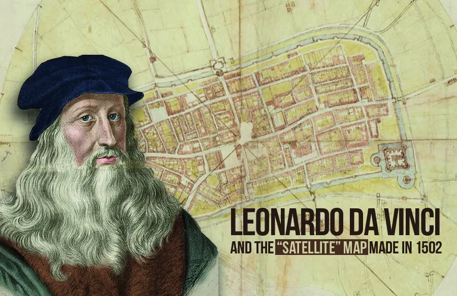
Leonardo da Vinci and the “satellite” map made in 1502
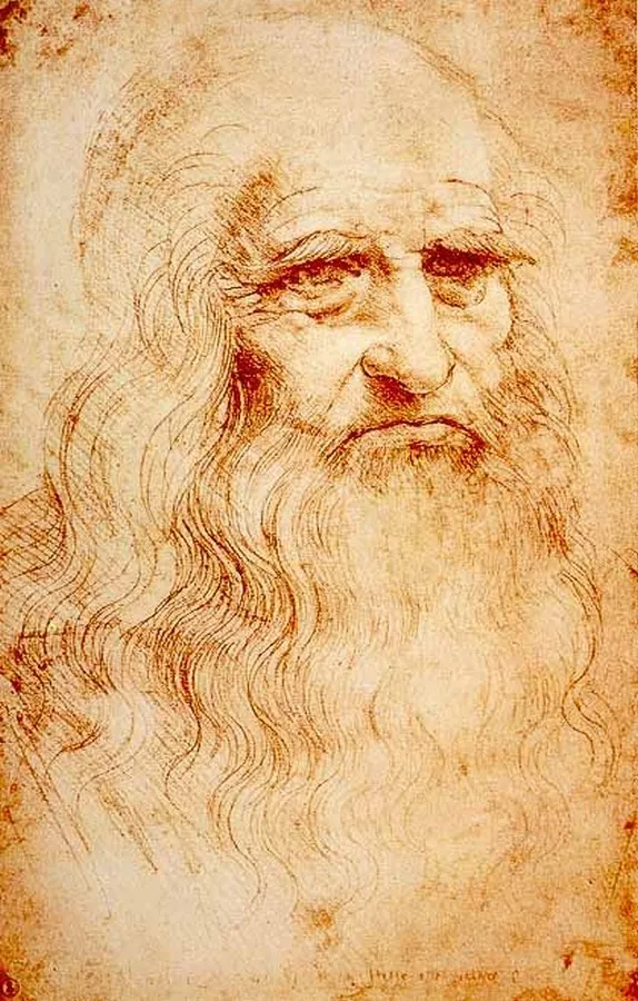
Leonardo Da Vinci was a famous painter, sculptor, artist, engineer, scientist, draftsman, and architect of the High Renaissance era. He is well known for his skills in both science and art. Da Vinci is best known for his paintings “The Last Supper” (1495-98) and “The Mona Lisa” (1503-19). His notes and drawings show his brilliant artistic and scientific mind.
Leonardo Da Vinci explored many areas of creativity and experimented widely. He believed that the eye is the most powerful sense, as what we see becomes our knowledge. Observation leads to questions and results in innovation. Leonardo mastered diverse fields, from paintings, sculptures, maps, and calculations to biological studies, body dissections, war defense devices, flying machines, and robots.
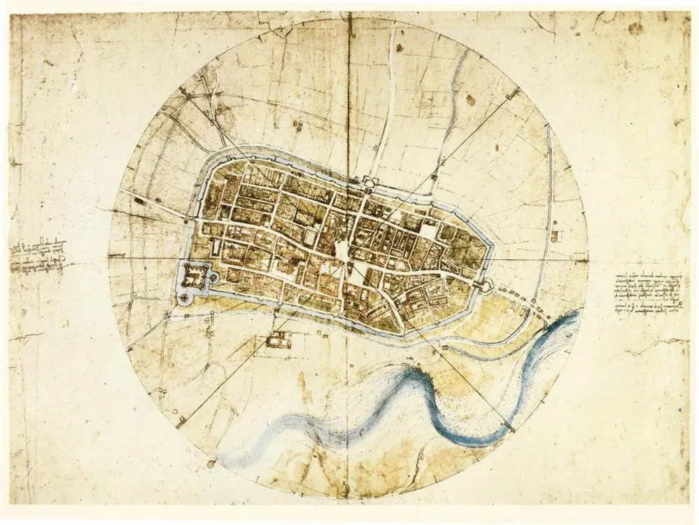
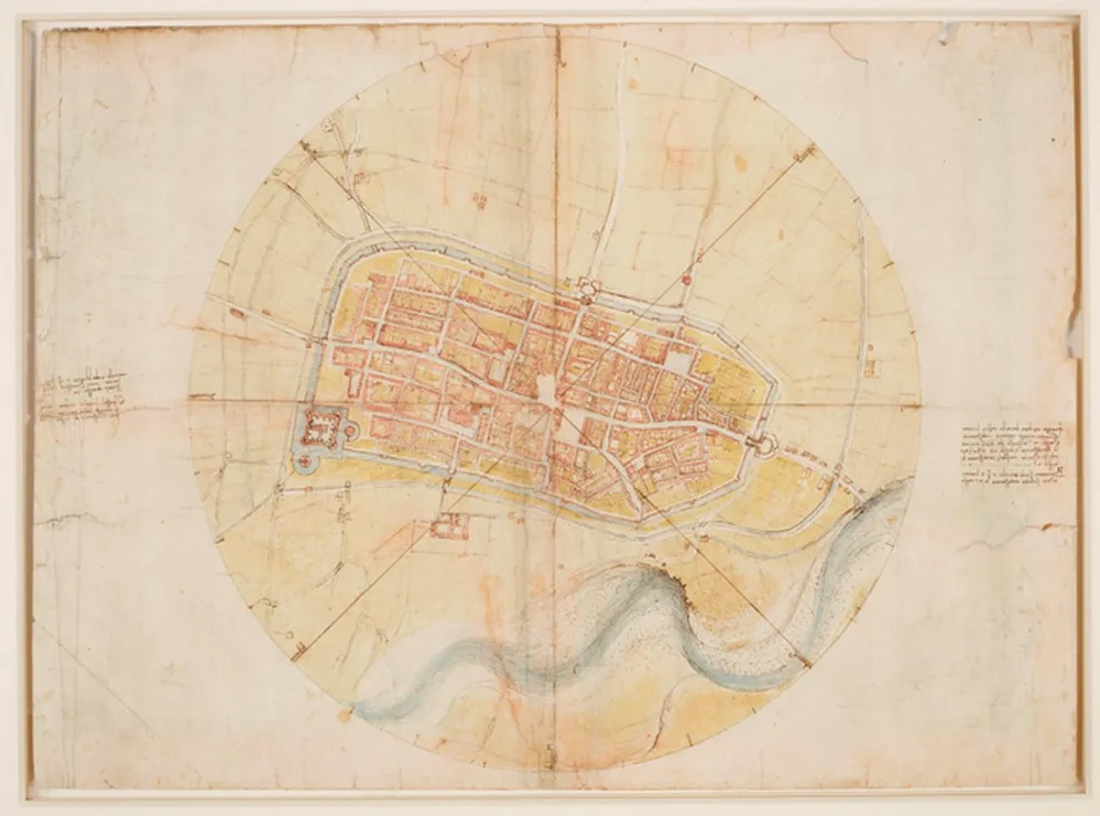
One of his lesser-known works is a map of the Italian town of Imola. Created in 1502, it is a hand-drafted satellite imagery map, far ahead of its time, and the oldest example of an iconographic map of the place. Leonardo was always interested in maps and optics. Maps made during the High Renaissance often featured castles, dragons, mountain ranges, and house elevations.
Usually, maps from that time were more about aesthetics than accuracy, often lacking proper measurements and scale. Precise measurements were hard to achieve due to the lack of technology and tools. Despite these challenges, Leonardo da Vinci created an accurate satellite map of the town of Imola.
Today, with advanced technology, we take such drafts for granted. However, almost 500 years ago, this was a significant innovation.
By the end of the 15th century, Leonardo was recognized as an established artist and a genius in many fields. He was also a military engineer and architect, known for his innovative ideas and problem-solving skills, especially in military advancements.
In the fall of 1502, Leonardo da Vinci was appointed “General Architect and Engineer” by Cesare Borgia, an army commander and politician. Borgia had seized the city of Imola in 1499 and needed a detailed map to control the fortified city effectively. He tasked Leonardo with this project.
Leonardo was ahead of his time, anticipating future needs. He experimented with flying machines to better understand aerial views, though none of his machines worked. Still, he recognized the flaws in existing mapping techniques.
Leonardo developed his own measurement tools, such as an odometer and a magnetic compass. He likely used devices like the Bussola to measure angles within a circle. He walked around the city, observing every block, street, and intersection, and manually measured all dimensions. This process was time-consuming, but essential for creating an accurate map.
Historians note that Leonardo da Vinci’s earlier works often focused more on aesthetics, emphasizing color and artistic value over precision. However, when drafting the map of Imola, Leonardo relied on mathematics and calculations.
He used a technique developed by Florentine humanist Leon Battista Alberti, which suggested mapping a town using polar coordinates. The central plaza served as the focal point, with the eight principal compass directions radiating out from it. This plaza was situated in the middle of the grid.
The map print is inscribed in a circle, with four lines running through the center to mark the eight polar directions. Leonardo’s handwriting names the winds on the map, and he used delicate colors to enhance its visual appeal while maintaining accuracy.
Today, we’re accustomed to Google Maps, offering various views like street and aerial perspectives, making navigation easy. The first satellite image was captured in 1946, and satellite maps were innovated in 2005.
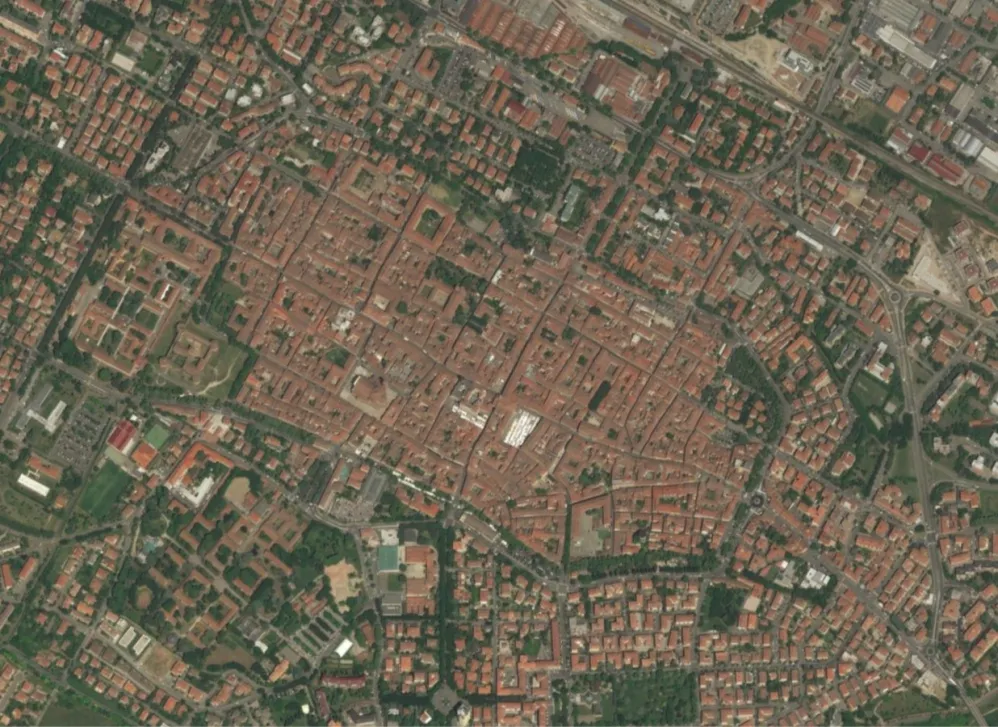
Though Leonardo rendered this map around 500 years ago, historians believe its dimensions and scaling are so precise that it could still be used to navigate Imola today!