The Scariest and Most Dangerous Roads in the World
Steep curves, sharp slopes, and the threat of landslides or avalanches—many of the world’s most dangerous roads come with serious risks. Here are nine of the most treacherous roads, stretching from India to Italy and beyond, for those seeking adventure. While these roads can lead to stunning destinations, they’re often best tackled with a sturdy vehicle and a knowledgeable guide.
The 99-turn Road, China
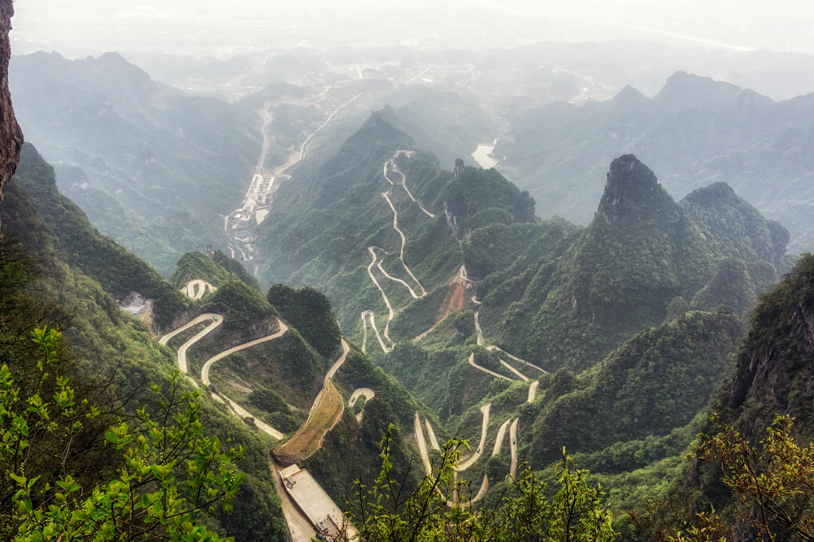
This road in Tianmen Mountain National Park, known for its 99 hairpin turns, winds through the mountains at nearly 6,561 feet above sea level. Only the most experienced drivers should attempt this route, as accidents are quite common, especially on steep sections or during bad weather. Additionally, there’s always the risk of earthquakes in the area.
Stelvio Pass, Italy
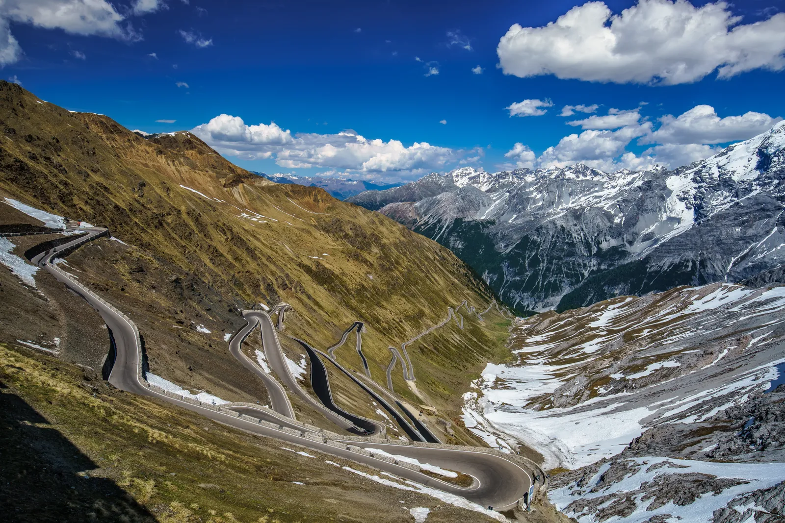
The Stelvio Pass, located on the Italian-Swiss border, is a mountain road in northern Italy that reaches 9,045 feet above sea level. With about 75 tight curves, Top Gear magazine has named it one of the best roads in the world for driving a Ferrari. However, it’s a challenge reserved for the brave, as the road often closes during bad weather and isn’t recommended for nighttime driving.
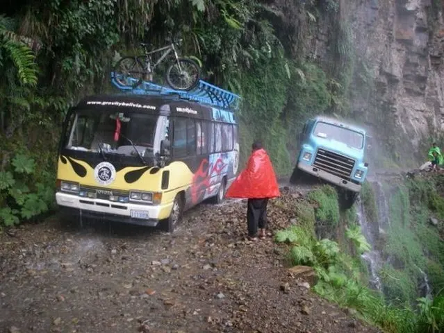
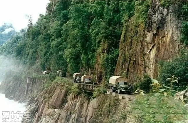
Death Road, Bolivia
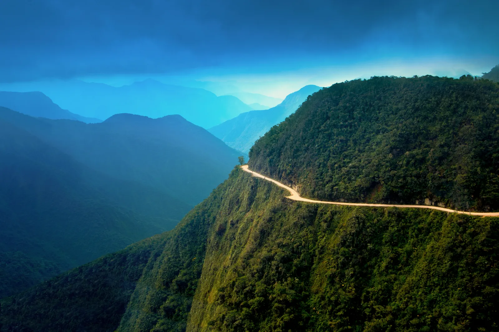
Often called the most dangerous road in the world, Death Road in the Yungas region of northern Bolivia overlooks the Amazon rainforest. But is the stunning view worth the risk? With 200 hairpin turns, deadly cliffs, landslides, and rock falls, the dangers are real. In fact, until the 1990s, around 300 people lost their lives here each year. Though traffic is now better regulated, fatalities still happen, making Death Road’s name tragically fitting.
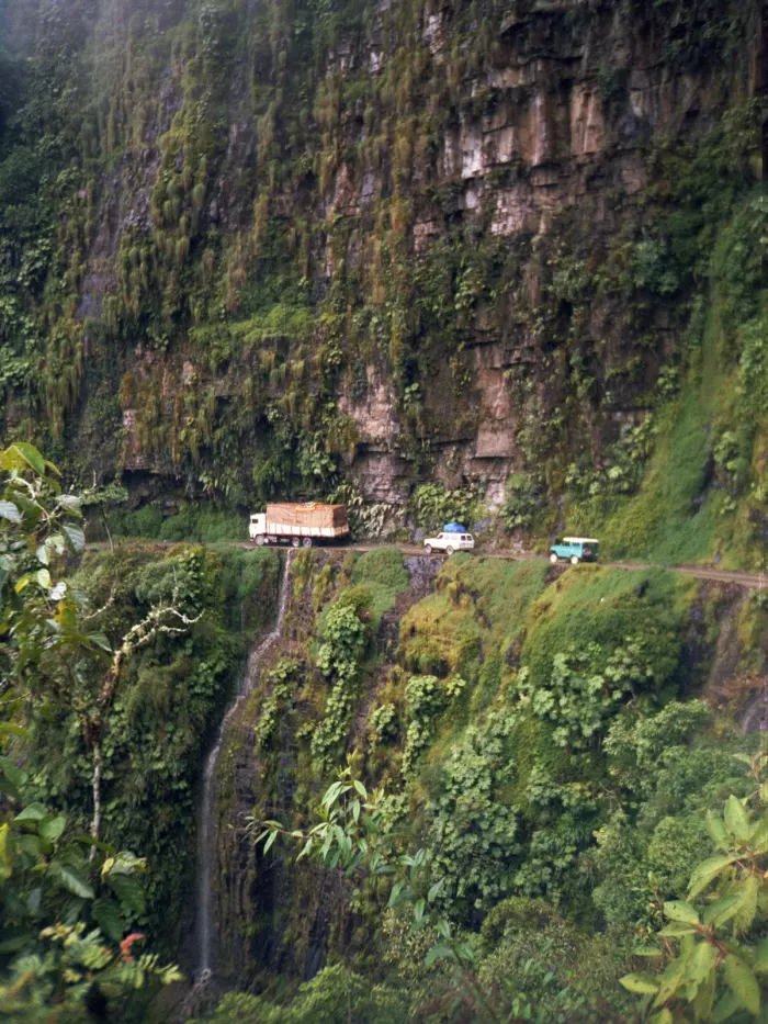
Cotahuasi Canyon Road, Peru
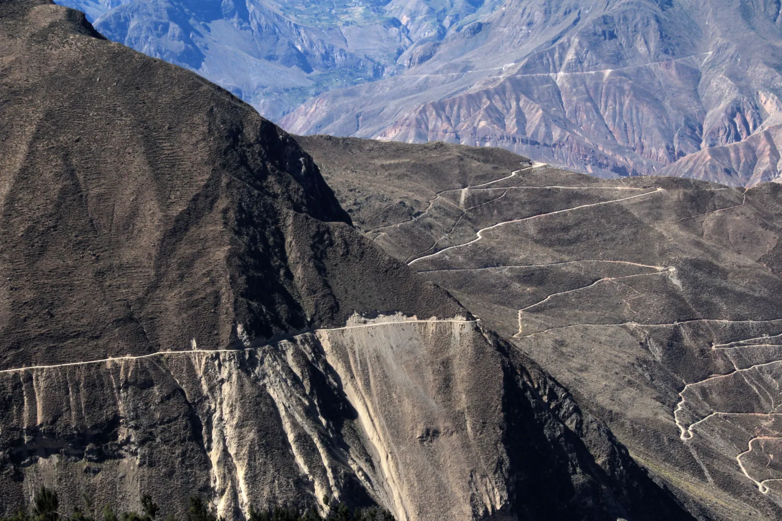
In southern Peru, this road winds through the world’s third-deepest canyon and takes about 10 to 12 hours to travel. The road isn’t fully paved and is ideally suited for 4×4 vehicles. During the rainy season, it becomes especially muddy and is usually closed for safety reasons.
Passage du Gois, France
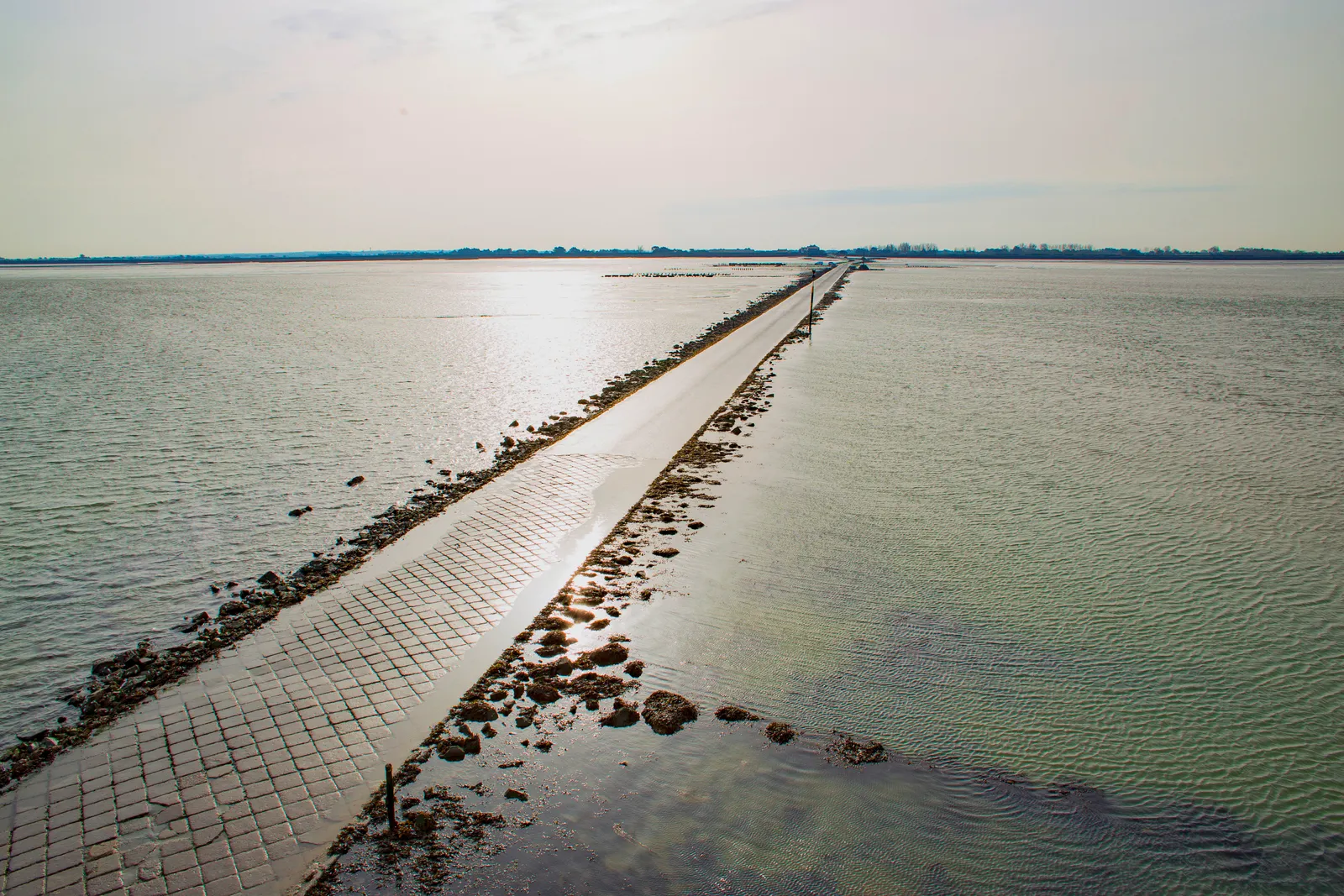
Despite France’s strong road safety record, there are still some risky routes, like the Gois Passage, which connects the island of Noirmoutier to the mainland. To reach the island, you have to cross a path that is usually underwater. Timing is crucial—there’s only a three-hour window to use the road before the ocean covers it again.
Sichuan-Tibet highway, China
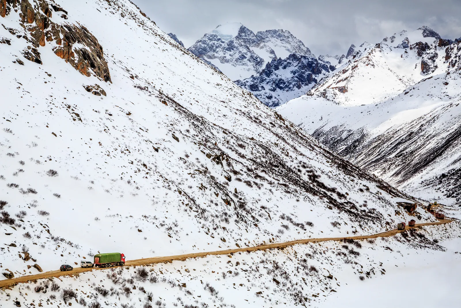
Since it was built in the 1950s, thousands of drivers have died on this highway, which has deterred many from using it. The area is always at risk of landslides and avalanches. Although it’s called a “highway,” it’s really a winding road through steep mountains. Fans of the film *Himalaya* (1999) might recall the tragic scenes of yaks falling on its narrow paths.
Katu-Yaryk Pass, Russia
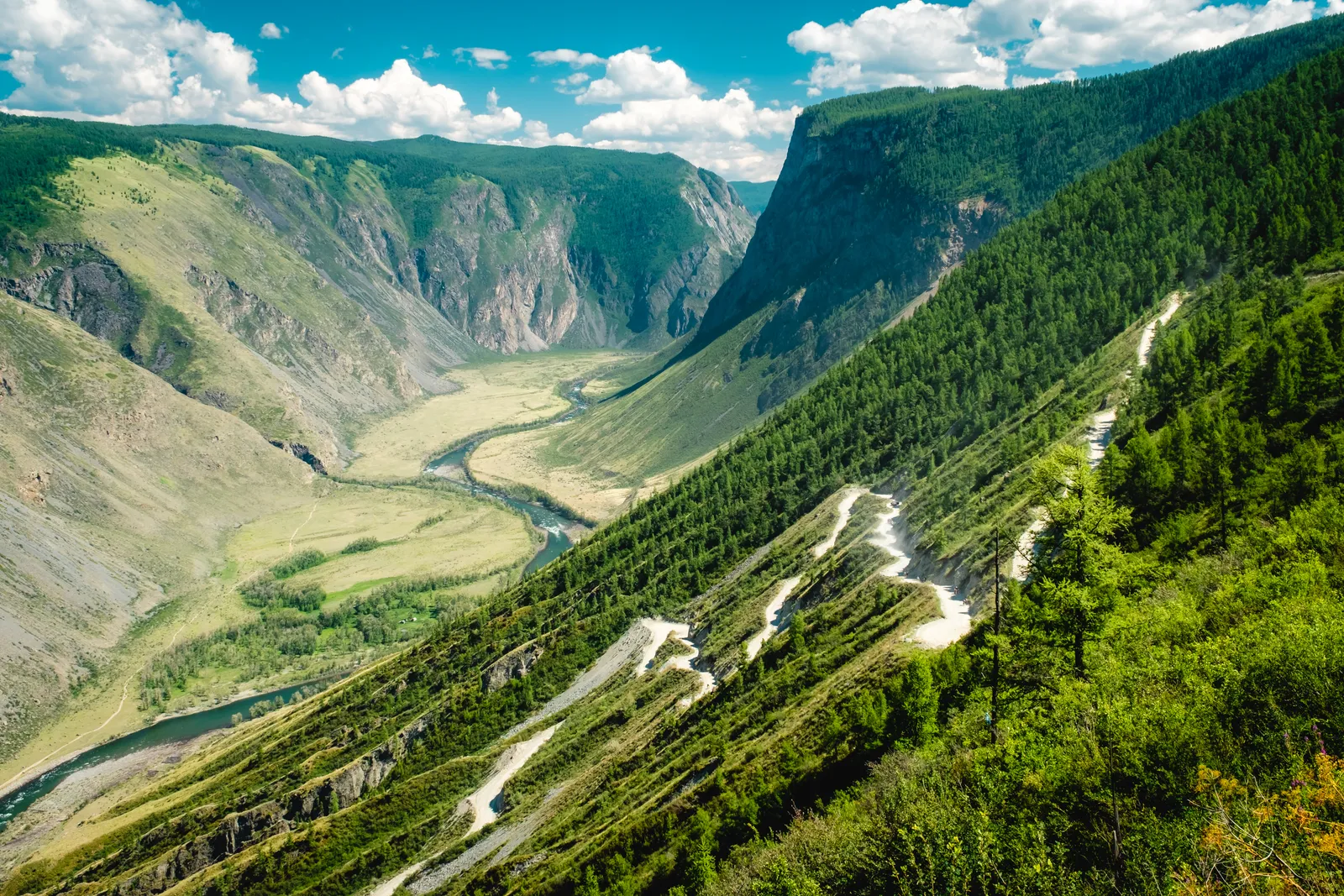
At an altitude of 3,937 feet, the Katu-Yaryk Pass in Siberia’s Altai region offers a stunning route to the mountain top. This road is meant for 4×4 vehicles only, as it is mostly unstable gravel with no guardrails. Drivers also need to cross small streams and navigate slopes with up to a 19% incline. The view of the valley from the top is breathtaking and makes the challenging drive worthwhile.
Also Check: The Earths Quietest Room It’ll Drive You Crazy: No one can stay in this room more than an hour
Zoji La Pass, India
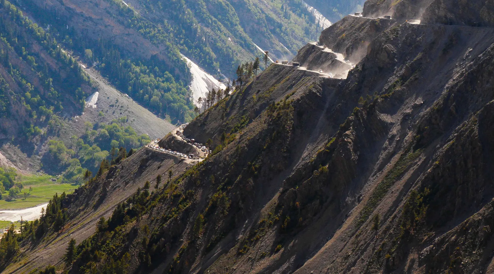
Central Asia has many dangerous roads, and one of the most well-known is the Zoji La Pass. This dirt road crosses the Himalayas, the world’s highest mountain range. With no guardrails or signposts, it faces frequent landslides and climbs to an altitude of 10,990 feet. Thankfully, the road is only five miles long and is closed during the winter.
Guoliang tunnel, China
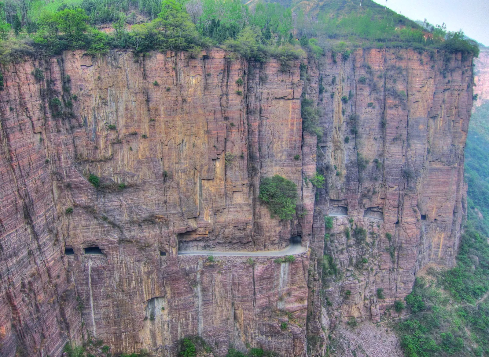
For those who are easily startled, it’s best to avoid this series of Chinese tunnels carved into the rock. The Guoliang Road winds through the mountains and has a daunting appearance. Despite this, it’s quite busy with buses, cars, and scooters. The road has narrow, blind turns along the cliff face but offers a unique view of the tourist site it overlooks.
Stelvio Pass (Eastern Alps)
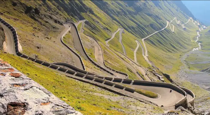
Location: Border between Italy and Switzerland
Length: Unknown
Maximum Elevation: 9,045 feet (2,757 meters)
Dangers: hairpin turns, steep grade
Top Gear magazine calls Stelvio Pass the greatest driving road in the world, though some experts believe the Transfagarasan Highway in Romania might be better. Driving Stelvio Pass in a Ferrari or another high-performance sports car is quite an experience. The road, which features 75 hairpin turns, is popular with cyclists and runners in events like the Grand Tour and Stelvio Marathon. However, it’s best to avoid traveling at night or during the winter when it is often closed due to weather conditions.
Cotahuasi Canyon Road
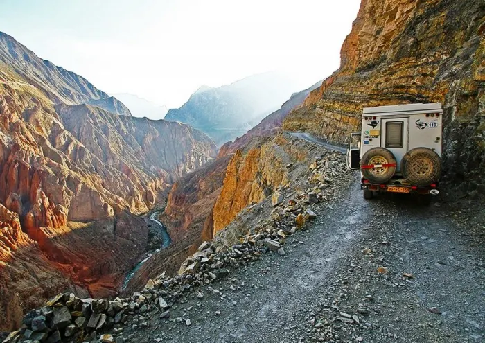
Location: Southern Peru
Length: Unknown
Maximum Depth of the Canyon: 3,525 meters or 11,595 feet
The Cotahuasi Canyon Road starts from the Pan American Highway near Arequipa and takes 10 to 12 hours to drive by bus. Beyond Chuquibamba, the road is unpaved and quite dangerous, so only four-wheel drive vehicles should be used. This rough and scary stretch is not yet crowded with tourists, and finding camping spots along the road is relatively easy.
For context, Cotahuasi Canyon is the third deepest canyon in the world, more than twice as deep as the Grand Canyon in the U.S. The deepest canyon is the Yarlung Tsangpo Grand Canyon in Tibet, which is 6,009 meters (19,714 feet) deep.
Taroko Gorge Road (Taiwan)
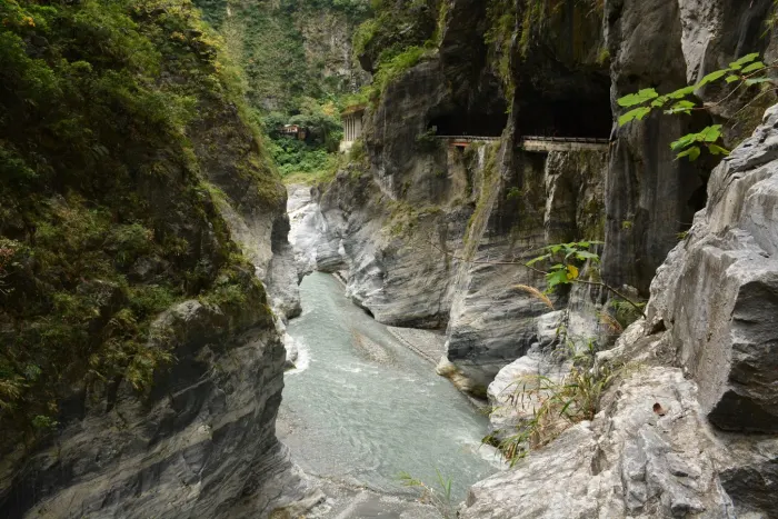
Location: Taiwan
Length: 11.8 miles (19 kilometers)
Maximum Elevation: Unknown
**Dangers:** Narrow, blind corners, rockfalls, landslides, flooding, earthquakes
Like the Guoliang Tunnel Road, Taroko Gorge Road is carved through the mountains. Despite its scary reputation, the road is popular because of its stunning views. This means tour buses, cars, scooters, cyclists, and pedestrians all share the narrow road, making it quite dangerous with its blind turns and tight curves.
The road is also difficult to maintain, as heavy rain and typhoons frequently cause landslides and rockslides, making some sections impassable.
Many who visit say the breathtaking views are worth the risk, but this road is not for the faint-hearted!
Sichuan-Tibet Highway (China)
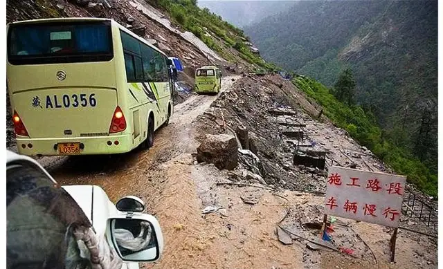
Location: China and Tibet
Length: 1,330 miles (2,140 kilometers)
Maximum Elevation: 15,420 feet (4,700 meters)
Dangers: Rockslides, mudslides, avalanches, hairpin turns, cliffs
The Sichuan-Tibet Highway stretches a long way from Chengdu in Sichuan to Lhasa in Tibet, passing through the Kham region. This dangerous road is frequently hit by rockslides and avalanches, and its winding path through high peaks often causes severe altitude sickness in travelers.
Along the route, you can see many Buddhist monasteries, monks in red robes, and herds of yaks. Built between 1950 and 1954, the highway has seen many accidents, with around 7,500 deaths for every 100,000 drivers.
North Yungas Road (“The Road of Death”)
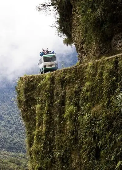
Location: Bolivia
Length: 49.7 miles (80 kilometers)
Maximum Elevation: 15,256 feet (4,650 meters)
Dangers: Landslides, rockfalls, fog, cliffs, narrow road, no guardrails
If you want to avoid a road called “The Road of Death,” steer clear of this one! Stretching nearly 50 miles from La Paz to Coroico, this road is just one lane wide and features steep drops of up to 3,000 feet into the Amazon rainforest below. It has over 200 hairpin turns.
Before 1994, nearly 300 travelers died on this road each year. Many makeshift memorials mark spots where people have fallen into the jungle ravines. Thankfully, a new two-lane paved road now bypasses the most dangerous parts, reducing vehicle traffic. However, cyclists still take on the challenge, and some have died trying. The South Yungas Road to Cochabamba is also considered nearly as dangerous.